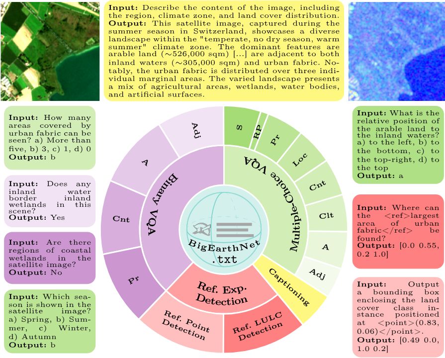
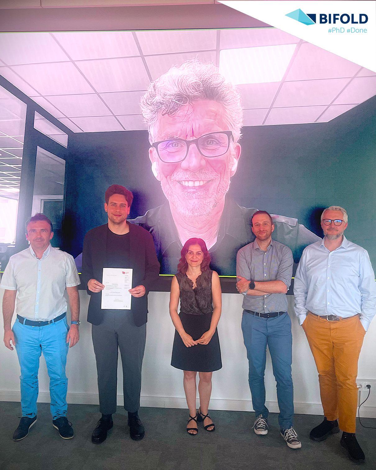
Welcome to RSiM
Remote Sensing Image Analysis Group

About

The Remote Sensing Image Analysis (RSiM) group at the Faculty of EECS, TU Berlin and the Big Data Analytics for Earth Observation (BigEarth) group at BIFOLD are led by Prof. Begüm Demir. Our groups perform research in the field of processing and analysis of remote sensing images for Earth observation with interdisciplinary approaches associated to remote sensing, machine learning, signal & image processing and big data management.

Latest News

Post thumb
  • 2024-07-10

BigEarthNet v2.0

We have recently released BigEarthNet v2.0 (also known as reBEN) that is a large-scale multi-modal remote sensing dataset made up of 549,488 pairs of Sentinel-1 and Sentinel-2 image patches. For details, please visit: bigearth.net.

Post thumb
  • 2024-01-18

Workshop in Berlin

We organize a workshop that aims to explore the emerging methods, approaches and systems in the context of Data Management and Machine Learning for Earth Observation.
Date: March 18th & 19th, 2024.

Post thumb
  • 2024-01-10

Open PhD Positions

The BIFOLD Graduate School offers 10 PhD positions, including a position on the topics of machine learning and data management for EO to join our team. For more information, please visit this link.

Post thumb
  • 2023-08-01

RSiM & BigEarth at IGARSS 2023

We presented 7 papers at IGARSS 2023 in Pasadena, California, USA. To read our IGARSS papers, please visit our publications page.

Post thumb
  • 2023-06-25

HySpecNet-11K

We have recently released HySpecNet-11k that is a large-scale hyperspectral benchmark dataset made up of 11,483 image patches acquired by EnMAP satellite. For details, please visit: hyspecnet.rsim.berlin.

Supported by

logo logo logo logo logo